Well, the Nordics are making some money moves, aren’t they?
This morning, Danish sensor startup Sapient Perception announced in an exclusive interview with Tectonic that they’ve raised a €2M ($2.4M) pre-seed round co-led by Balnord and FORWARD.one.
The company says it will use the money to “accelerate development of the company’s software-defined cameras and AI framework that enable mission-critical decision-making and autonomy through large area perception.” They’ll also massively expand their engineering team.
“[This raise is] for us to get up off the ground, to find product market fit and to have our initial product,” Anthony Garetto, CEO and co-founder of Sapient Perception, told Tectonic. “We have prototypes now, and we’ll be going into production in the May to June timeframe. It’s been a pretty interesting ride—we’ve had a lot of traction, very fast.”
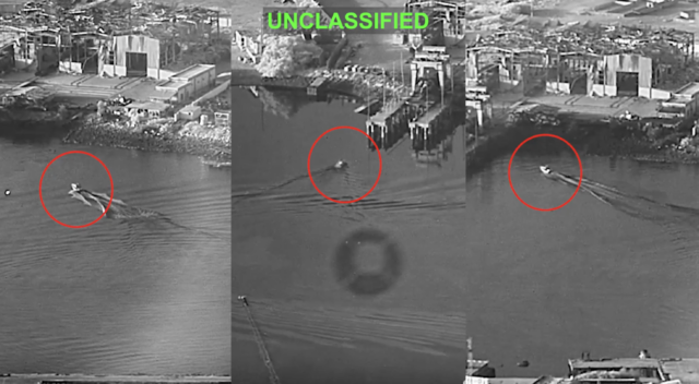
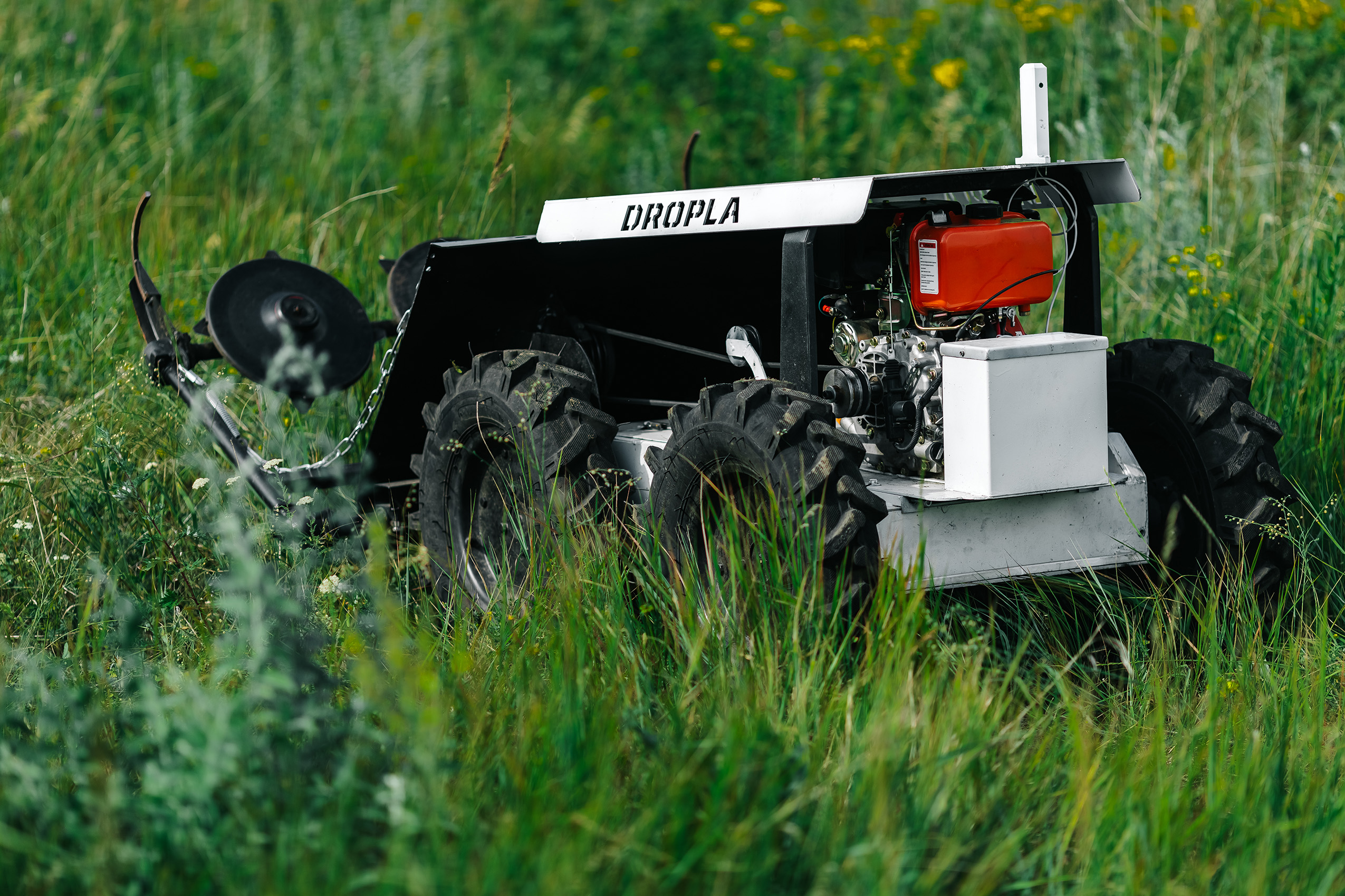
Simultaneous with the raise, the company also told Tectonic that they are working with Danish-Ukrainian demining startup Dropla Tech to “integrate Sapient’s large area perception sensors into UAVs designed to fly low and ahead of military convoys…to detect ambush drones and landmines along supply routes near Ukraine’s front lines.”
They’re planning to get the tech in the hands of Ukrainian operators “on this side of the summer,” Garetto said.
Pre-seed to deployment real quick.
Super-seer: Sapient is pretty safely on the nuts and bolts side of defense.
The company came out of stealth earlier this year and set out to address a pretty simple-seeming problem: In large areas (say, like in the middle of a battlefield in eastern Ukraine), it’s pretty dang hard to see teeny-tiny, ultra-dangerous things like mines.
- The company was founded by Anthony Garetto (CEO), Lau Norgaard (CTO), and Michael Messerschmidt (CBO)—all veterans of the high-resolution imaging and drone spaces.
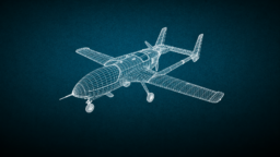
- They’re building “software-defined cameras” that basically use a combo of ultra-powerful lenses, edge compute, and AI analysis to scan large swaths of land for threats.
- Their edge (get it) lies in “first-of-its-kind 10K sensors that cover up to 100 times larger areas than conventional sensors at the same detailed resolution in a single frame.” Think ultra-high-end cameras packed onto a drone.
- Plus, they’re doing processing of those ultra-detailed images (using Nvidia chips and whatever AI model operators are using) on board, which helps overcome bandwidth and latency issues. It only beams down analysis and findings to ground control.
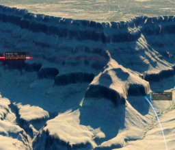
- The result is basically a map of a battlefield that shows you where danger is. Helpful if, say, you’re in a convoy near the frontline—the idea is to get as high-resolution imagery as possible to frontline operators, as quickly as possible.
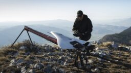
Cubism: The whole camera-sensor system is about the size of a Rubik’s cube, weighs about 500 grams, and can be plugged onto most UAVs.
- The team was careful to say that it’s not on the “ultra-cheap” side of things, but that it’s a lot cheaper than your bog-standard military-grade sensors or cameras.
- Each unit costs about €20K ($23.6K) and is definitely intended for the ISR side of things, rather than one-way strike drones. Don’t really want to be losing a camera the same price as a car on a battlefield.
- The systems spit out a “perception layer” (read: threat map) that can be fed into most C2, from Lattice to ATAK.
Breaking through: We asked the Sapient team what the real breakthrough was here—in other words, how had they managed to raise this cash money?
Norgaard told us that—put simply—they’ve managed to balance speed, resolution, and processing in a way no one has before.
“Everybody else who designed the camera until now, they designed it based on what you can stream down,” he said. “It never made sense to choose a sensor that’s bigger than what you can compress and send down.”
But by bringing the processing on board the UAV—using some fancy shmancy Nvidia chips—operators are able to receive high-quality data without having to beam down oodles of high-resolution images through an RF link.
“It’s only in the last year or so that it can actually be possible that you decouple the sensor selection from the radio link availability,” he said. “That is the game changer, and the fact that we can only do that because we only send down the findings, which means they individually consume less, much less bandwidth…we only send what’s important.”
BFFs: Beyond Dropla, Sapient says once it scales up production this summer, it will look to sell to other OEMs and drone-makers. The nifty thing about the cameras is they can work on just about any size drone at pretty much any altitude—you just gotta add more units.
“Our customers right now range from the mine clearing case that we mentioned, flying in very low altitude with a quadrotor or single rotor drone, all the way up to stratospherics, balloons that are doing very large area surveillance,” Norgaard said.
Basically, anywhere you need to scan a large area quickly, the tech is helpful, Messerschmidt added.
“It’s basically all about finding small things in large areas in real time,” he said. “How small small things are and how large the area is—that’s relative. In the mine-clearing case, small is really small, like pixels are two millimeters on the ground. Another case could be monitoring ships in the Baltic or in the Arctic. [There], small things are big ships, but in super large areas.”