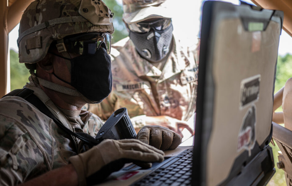
If you thought the Crow Industries and Parry Labs mash-up was the only collab to come out of the Army’s xTech Overwatch competition, think again.
This morning, GPS-free navigation company TERN and AI-powered simulation and planning company Sandtable announced in an exclusive release to Tectonic that they’re teaming up after the exercise to plug Sandtable’s mission planning capabilities—especially its geospatial mapping— into TERN’s navigation stack.
“What’s impressive about Sandtable is how they handle geographic data,” Brett Harrison, co-founder and president of TERN, told Tectonic. “They’ve figured out how to take what would normally be terabytes of information and compress it into something lightweight and usable. It fits right into our system without friction.”
It pretty much sounds like the data Sandtable has collected for mission planning is pretty invaluable for a company figuring out how to plan and navigate—accurately and autonomously—without satellites.
“In order to build…our Sandtable platform for planning, we have to start our process by creating and applying a very detailed geospatial baseline to the plans,” Sandtable co-founder and COO Brady Moore told Tectonic. “The fact that we’re doing it very detailed makes…this underlying data set pretty valuable for unmanned ground systems.”
Man, cliques really do be forming in defense tech land faster than a high school lunchroom.
Turning tables: Let’s kick things off with TERN.
The company was founded back in 2022 in Austin (shout out) by a team of veterans and AI developers who—put simply—wanted to build a better way to get around, especially in a world of autonomy and jamming.
The result? A patented navigation system called Independently Derived Positioning System (IDPS™), which basically uses maps and existing onboard sensors to help ground vehicles navigate without GPS/GNSS.
- Think of it kind of like how a human uses a paper map—you look at the world around you, then look at the map, and use what you see (say, a weirdly shaped junction) to figure out where you are.
- This set-up brings the whole “where the heck am I” thing onboard the vehicle—no connectivity required, which means no real risk of jamming.
- The company is tested by the US Department of Transportation, but is also a hot commodity in defense land—after all, a navigation system that can’t be jammed and is road-tested is real useful for things like UGVs.
- TERN was a finalist in the Army’s xTech Overwatch competition and was also selected as part of NATO DIANA. They also raised a $7.5M seed round last year.
Map it out: What Sandtable brings to the table (bada-bing!) are its planning capabilities, plus all the off-road geographic data it’s amassed to build its AI-powered mission planning setup.
- The company has taken AI and modern simulation and applied it to mission planning. The software sifts through data (like geospatial data), protocol, materiel stocks, and all the other fun stuff that commanders usually have to go through by hand and suggests courses of action to operators based on that.
- Basically, the tool allows commanders to plan and simulate different mission plans without, like, pen and paper.
- The company is backed (at an undisclosed amount) by Silent Ventures and Quiet Capital.
“We’re building a very purpose-built platform that takes a lot of those processes and planning around information retrieval and probability testing and simulation…and we’re automating them as much as possible,” Moore said.
As part of this, the company has amassed tons of terrain data—like, down to the length of grass, according to Moore. They’ve done so to help operators better plan how to deploy assets—but that kind of microscopic detail is also really useful for navigation and positioning.
“You need a lot of data over a particular area in order to have a good idea of where [your] unmanned or autonomous ground system can or can’t go,” he added.
Basically, TERN + Sandtable = end-to-end planning and navigation that doesn’t need those pesky, jammable satellites or RF feeds.
Real world: At xTech Overwatch, Sandtable basically plugged all available information on all of the different unmanned and autonomous assets people were playing around with into its planning system, which helped operators figure out how to better deploy them.
“[We had] our system recommend to [operators] how to use each one of those autonomous systems,” Moore said. “Say, if you’re trying to seize this location and your people are going this way and doing these things, here’s where you should put this autonomous ground system, because it can be used either for observation or as like a moving land mine.”
That scope and level of detail is what caught TERN’s eye.
“TERN and Sandtable bring planning and execution into a single, seamless workflow that actually holds up in those environments. Whether those systems are autonomous or human-operated, across wheeled or tracked platforms, the need for reliable positioning and planning doesn’t change, and neither does the value we bring,” TERN co-founder and CPO Phil Reason told Tectonic.
Reason added that the company already has customers that they can deliver the joint capability to and that it’s applicable way, way beyond defense.
“Anywhere vehicles are operating in safety-critical or high-risk environments, whether that’s defense, emergency response, or commercial operations, there’s a real need for this kind of capability,” he said.