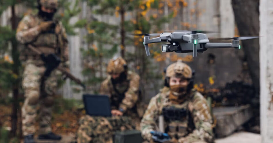
You know what sucks? When you think you’ve got a drone flying good and straight over a target, but then it turns out you’re like, super off base.
Well, luckily, one prime-new kid on the block partnership is here to help. This morning, Vantor (the artist formerly known as Maxar) announced that it’s teaming up with BAE Systems to integrate part of its vision-based autonomous navigation system, Raptor, into BAE’s Geospatial eXploitation Products (GXP) suite of GEOINT tools.
Basically, the team-up will mean that autonomous systems using Raptor on GXP will have “multi-domain interoperability across different sensors, and accurate ground coordinate extraction at a demonstrated absolute accuracy of <3 m.”
“GXP is known across the community and around the world, really, as a powerful exploitation software,” Paul Millhouse, senior director of Raptor products at Vantor, told Tectonic. “It’s used by a number of defense and civil users, and this is going to now marry in that Raptor capability that allows the video to be in the right spot.”
Sounds pretty good, if you ask us.
Hit the spot: Now, you might be sitting there thinking—wait, doesn’t Vantor do intelligence? What are they doing with drone targeting and navigation?
Well, they do both, friends. Last year, the geospatial intelligence company unveiled Raptor, an Alternative Positioning, Navigation, and Timing (AltPNT) software, which uses 3D mapping to help automated systems navigate without GPS.
The software basically uses Vantor’s satellite-based intelligence to spit out a 3D map drones can use to navigate when those pesky jammers are near. “You’re basically getting this living representation of the battle space, not in terms of video feed or pixels, but actually in terms of 3-dimensional structures,” Peter Wilczynski, Chief Product Officer at Vantor, told Tectonic last year.
Raptor is comprised of 3 parts:
- Raptor Guide: a vision-based positioning system, which provided a location within 10m of GPS when tested on a Cessna last year.
- Raptor Sync: software that merges a drone’s real-time video with decades of Vantor geospatial data, creating a pretty accurate 3D rendering of the world.
- Raptor Ace: software that can be installed on a laptop that combines Vantor’s 3D map with a drone’s live feed in order to pull out coordinates (with an accuracy of <3m) for targeting and delivery.
The bit that’s central to this team-up is Sync, which will “georegister the full-motion video feed from the drone’s on-board camera with Vantor’s 3D terrain data in real-time.”
- Even the most advanced drones, sensors, and cameras struggle with drift, where “high-quality imagery is available, but the underlying geographic coordinates are too inaccurate for precision activities.” That means, basically, operators can’t be sure targeting is accurate.
- Raptor Sync is basically a failsafe now built into GXP to combat that. “By including Raptor directly into our GXP intelligence workflows, we are providing analysts with the ability to maintain absolute targeting confidence, even when the platform’s systems or inertial sensors lack high absolute accuracy,” Kurt de Venecia, Sr. Director of Product Development at BAE Systems GXP, said in a statement.
- If we want to get technical about it: Key-Length-Value (KLV) metadata from Raptor will feed into the drone’s video stream, which will keep location and targeting accurate at the edge for any autonomous system using GXP.
“In any kind of modern conflict that’s going on right now, you have intelligence, surveillance, and reconnaissance assets that are out watching for things,” Millhouse said. “The whole point of the ISR asset is to identify where objects and targets of interest may reside. This will give them accurate coordinates to then be able to take action with no ambiguity.”