Vantor really just keeps stacking wins.
This morning, the geospatial intelligence giant announced that it’s been awarded a five-year contract (with a one-year base) by the Naval Information Warfare Center (NIWC) Pacific to “deliver maritime intelligence capabilities supporting missions across the Indo-Pacific.”
The company could not disclose the value of the contract.
Specifically, Vantor says it will deliver its Maritime Sentry product (specifically designed for tracking ships, especially of the “dark” variety) in support of “NIWC Pacific’s work with the Indian Navy, and regional partners, participating in the Indo-Pacific Partnership for Maritime Domain Awareness, or IPMDA.” Making new friends. We like it.
- For context: IPMDA is a US-led initiative launched in 2022 to give Indo-Pacific partners better access to satellite-based maritime surveillance and help them monitor their territorial waters.
“The Indo-Pacific is an enormous maritime operating environment, with critical shipping routes, military activity and illicit activity all happening across vast areas,” Will Cocos, executive VP and general manager of Vantor’s U.S. government business, told Tectonic via email.
“The challenge is visibility. Vessels can turn off or manipulate AIS, and no single sensor gives you the full picture,” he added. “Operators need to know what’s there, identify what matters, and get that information quickly enough to act. Maritime Sentry helps bring those sources together to give operators a broader, more current, and persistent picture of activity across the region.”
Pie in the sky: Vantor is pretty much the OG when it comes to seeing stuff happening on Earth from space.
- The company operates one of the largest Earth observation satellite networks—including a ton of WorldView satellites inherited from its predecessor, Maxar.
- But it’s not just satellites—the company combines satellite imagery, AI, and software to help governments and commercial customers understand what’s happening on the ground.
- Its flagship software platform, Tensorglobe, fuses data from satellites, drones, aircraft, and ground sensors into a single common operating picture.
- They also use all that geospatial data for 3D mapping—their Raptor Alternative Positioning, Navigation, and Timing (AltPNT) software (unveiled last year) helps automated systems navigate without GPS, for example.
Out at sea: Maritime Sentry takes all that good good data and uses it to track vessels around the world—especially those that aren’t playing by the rules and have disabled their trackers.
- The tool uses broad-area sensors—particularly third-party synthetic aperture radar (SAR), which works through clouds and at night—to search thousands of square kilometers of ocean.
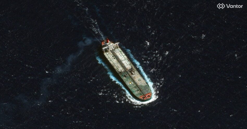
- When SAR finds something interesting, Sentry can automatically task Vantor’s own high-resolution electro-optical satellites to get a better look. The orchestration is automated—that saves a bunch of time.
- The company’s models can then ID the ship using that data combo.
- And here’s the cool part—Sentry can then do AI-powered vessel “fingerprinting,” as Vantor says, which basically creates an identity for a vessel (even if it’s dark).
- That fingerprinting then lets users track vessels even if they switch off AIS (or never broadcast AIS in the first place).
- Cocos said that the tool is “near real-time, not simultaneous…[and] can detect and identify vessel activity within minutes of satellite collection and push those insights into the customer’s operational workflow.”
Vantor couldn’t ID other specific customers (beyond NIWC Pacific and the Indian Navy), but says the tech is being used by “US government, international government, and private-sector customers.”
- The company also said Sentry was used to track a sanctioned Venezuelan oil tanker seized by the US government late last year.
Use what ya got: The cool thing about this contract is that Vantor is plugging Maritime Sentry directly into the Indian Navy’s existing workflow.
- Basically, they’re delivering Sentry as an application programming interface (API), rather than a standalone interface.
- The tool will plug into “SeaVision, a US government application used to view, share and correlate maritime information from multiple sources,” as well as the Indian Navy’s own system.
“The technology is only part of the story. How you get it to the operator matters just as much,” Cocos said. “You can build great technology, but if you make the operator leave their existing workflow to use it, you’ve created another problem. Getting trusted information into the hands of operators quickly, in the tools they already rely on, is what makes the capability operationally useful.”