There’s been a whole lot of lessons learned from the war in Ukraine, but one of the biggest is that the modern battlefield is rife with jamming, spoofing, and electronic warfare. For vehicles and troops operating in that environment, knowing where to go when signals—especially GPS—get jammed gets pretty tricky.
TERN thinks it has the answer, and they’re teaming up with the big dogs to make it even better.
This morning, the Austin-based startup announced it has integrated BAE’s NAVGuide system—which uses the military’s encrypted GPS signal for operations in contested environments (called M-code)—into its GPS-free ground vehicle navigation platform, giving operators a full range of options for navigating in denied environments.
- Basically, if operators want to (or can) use M-code, TERN’s platform brings it in through BAE’s NAVGuide, or other systems that use it. If that’s blocked, TERN’s system can keep things running so soldiers know where they are, no matter what.
- It’s also the startup’s first full demonstrated integration with a prime, but they’re “working with a few [others] right now,” TERN co-founder and CEO Shaun Moore told Tectonic.
“If they have a need for M-code, or if they have a need for timing, we can bring BAE’s NAVGuide into ours to provide that to the customer,” Moore said. “If the vehicle doesn’t need it, then obviously we don’t need to include it, but it’s a robust new generation of positioning and navigation intelligence at the edge of the vehicle that can take these various forms and output the best possible solution to the warfighter.”
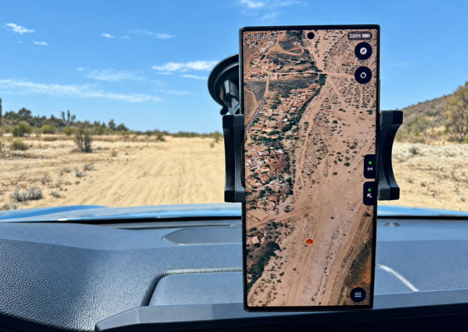
Map it: TERN, to back things up, was founded back in 2022 in Austin by a team of veterans and AI developers who, put simply, wanted to build a better way to get around, especially in a world of autonomy and jamming. The result is a patented technology called Independently Derived Positioning System (IDPS), which TERN co-founder and president Brett Harrison describes as the “Google Maps of the battlefield”—without the GPS.
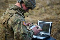
- It runs on a standard tablet and plugs into the vehicle to retrieve sensor information, which TERN’s in-house AI bolsters to make it smarter. It then pre-loads maps of a geographic area to give soldiers “a similar experience to what [soldiers] currently use with Google Maps or Apple Maps,” Harrison said.
- The tablet and system are completely air-gapped, but “if we do have communication capability, we built out an integration with Anduril’s Lattice and Palantir’s Maven, so we can beam up the position, the routes that are intended to be taken.”
- They snagged an $11.26M contract earlier this month to integrate IDPS and their vehicle health system into a wide range of the Army’s ground vehicles.
Full suite: To go back to basics for a sec, military navigation is built on Positioning, Navigation, and Timing (PNT). With this partnership, TERN’s IDPS brings the GPS-free P and N part of the equation, and BAE’s NAVGuide brings in the secure GPS with M-code and the T.
That’s important because it makes TERN’s platform more than “just a singular product that the Army can procure—it’s much broader than that,” Moore said. “We’re bringing intelligence into that vehicle at the edge, and then taking in any source of information that the Army wishes to have, and… creating more of an ecosystem.”
“It really also just shows the tight-knit collaboration that we’re starting to develop with companies like BAE to be able to combine forces into this ecosystem that we’ve created and are now deploying to make it more meaningful across the board,” Harrison added. “We believe the future of military positioning should not be restricted to choosing one positioning methodology over another.”