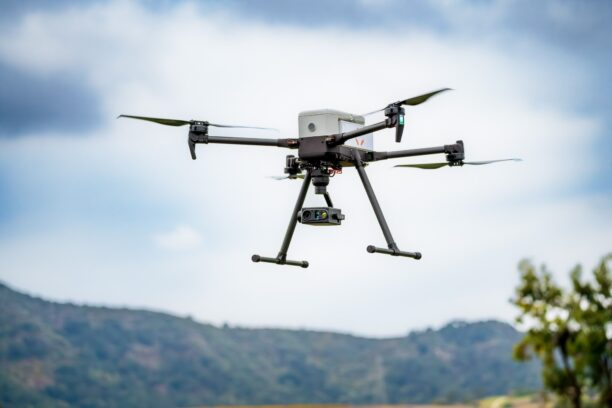
You know what sucks? When you’ve got a drone on mission with no (or limited) comms and it gets lost with no satellite data to fall back again. Can be a pretty pricey—or at least deeply annoying—issue.
Well, good news is, visual navigation startup Vermeer has come up with a solution. This morning, the company announced in an exclusive release to Tectonic that it’s built a new feature called “Recovery,” a “safeguard for its visual navigation platform that allows drones to re-orient themselves in mid-flight after losing track of where they are, all without relying on GPS.”
Basically, Recovery corrects the drift that can happen when drones are navigating visually (rather than using GPS), keeping them on mission—especially over featureless areas like large bodies of water or dense forest.
“If you do longer missions, you are going to get lost at some point,” Vermeer CTO and co-founder Suresh Kumar told Tectonic. “You could get lost once, you could get lost five times. So, you need something that you could fall back on that allows you to reinitialize.”
The feature is designed to work hand-in-hand with Vermeer’s flagship Visual Positioning System (VPS) and will be available as an upgrade to the system.
Eye in the sky: Vermeer was founded back in 2018 by former aerial cinematographer Brian Streem, who basically realized how useful cameras on drones could be while using UAVs to shoot movies. So, he switched to defense tech.
The company’s flagship VPS visual navigation system enables drones to determine their precise location in contested, spoofed, and GPS-denied environments.
- Vermeer’s tech draws on up to four drone-based EO/IR camera feeds simultaneously, which cross-reference locations using a locally stored 3D map database.
- The system is trained on over 25,000 hours of aerial video of different terrains, weather conditions, and times of day, including nighttime.
- This “vision” allows drones to accurately and autonomously navigate in areas where satellite or RF-based navigation is degraded or denied, including on ultra-low-altitude flights that avoid air-defense radars and interceptors.
- This tech has proven pretty popular pretty quickly. Stateside, Vermeer’s customers include Lockheed, Northrop, Anduril, AV, and Firestorm, as well as Ukrainian drone-makers like Skyeton.
- The company also raised a $10M Series A led by Draper Associates late last year.
Off the beaten track: But here’s the thing—even though VPS itself “delivers extremely precise corrections over short distances when the drone already has a rough idea of where it is,” visual navigation ain’t perfect.
- Recovery is built for when drones go, like, way way off track, “when the aircraft has drifted so far that it no longer has a reliable guess at all,” per Vermeer.
- This tends to happen over areas where visual positioning systems don’t have anything distinctive to lock onto, like over open water or a large field.
- Basically, as the drone flies Recovery takes pictures of the ground beneath it—refreshing the image every 15-20 seconds.
- If a drone loses its bearings, the system compares those snapshots to its onboard maps in two stages. “First, a coarse search narrows things down to the broad region the aircraft is most likely in,” Vermeer wrote in a statement. “Then a fine search matches the live camera imagery against satellite reference maps to pinpoint the position.”
- Once it figures out where it is, it can then get back to normal flying.
Kumar compared it to the way humans use landmarks—like a tree or a bench or a fork in the road—to reorient when they get lost.
“The aircraft does the same kind of thing,” he said. “You build out a bird’s-eye-view image of the map area that you’re flying [in], you capture a small piece of the puzzle [with the camera], and you use that when you’re lost…like, I know where this thing was, so let me go back and put that into the larger context.”
On the frontline: And it sounds like it actually works.
- The feature is currently in field testing and has re-established a drone’s position after a drift of up to three kilometers, per the company.
- Recovery has a “reported 95% success rate at around one kilometer of drift and roughly 80% at distances approaching three kilometers,” according to Vermeer.
- Vermeer has successfully used Recovery during field testing in Ukraine and “measured reductions in positioning error under real operating conditions.” Good to make sure it works in the jammiest of jammed conditions.
Lost drones, no more.